
|
|
|
|
| VHF: Canal 77 |  |
 |
 |
 |
 |
|
|||||||
| Avisos | ||||
 |
|
|
Herramientas | Estilo |
|
#1
 05-07-2009, 11:56
|
||||
|
||||
|
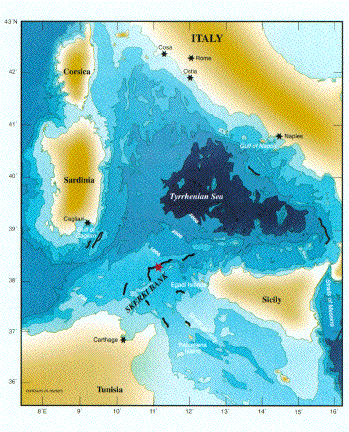
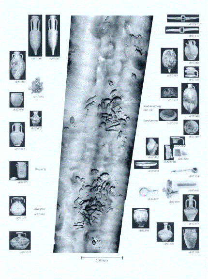
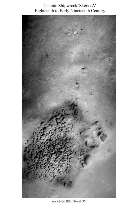
Yo no sabía que existía, pero parece que bién en medio del canal de Sicilia hay un arrecife llamado Skerki Bank.
En este hilo: http://foro.latabernadelpuerto.com/s...ad.php?t=38424 me he bajado el derrotero de todo el mediterráneo occidental de los americanos aquí: http://164.214.12.145/sdr/ No es muy detallado como una Imray, pero tiene el sabor de los derroteros antiguos y contiene mucha información. Pues bién, parece que aquí en medio:  hay un bajo con sondas de medio metro  En la wiki:http://en.wikipedia.org/wiki/Skerki_Banks Por lo que he leído en la red, es un interesante yacimiento arqueológico de barcos que unían Cartago con la vertiente norte del Mediterráneo. Parece que en la WW II pasó algo por allí. Vaya susto de sitio. Pero encontrarlo un día del mar como un espejo y aproximarse con buena cartografía tiene que ser impresionante. Y bañarse allí ni te cuento Y la descripción del derrotero NGA: Off-lying Banks 14.1 Skerki Bank (37°50'N., 10°55'E.) is centered about 35 miles NNW of Ras at Tib (Cap Bon), which is described in paragraph 8.14, and extends for about 35 miles in a general NE-SW direction. The bottom of this extensive bank consists of coral, rock, sand, and shells. 14.1 Sylvia Knoll, lying at the NE end of Skerki Bank, has a least depth of 12m. Biddlecombe Reef, with a depth of 6.7m, lies about 7 miles SW of Sylvia Bank. 14.1 Locust Patch, with a depth of 12m, lies 5 miles W of Keith Reef. Hecate Patch, with a depth of 7m, lies about 2 miles S of Locust Patch. 14.1 Keith Reef is the shallowest patch on the bank. It lies nearly 2 miles SSE of Biddlecombe Reef and is composed of compact limestone. A small rock, covered with weed, lies at the center of this reef and has a depth of 0.3m. It is usually marked by breakers. It is reported that the remains of a stranded wreck lie in the vicinity of this rock. In addition, two dangerous wrecks lie at the NE end of the rock. 14.1 Caution.—The currents in the vicinity of Skerki Bank are irregular in both rate and direction. The shoal patches are not always marked by breakers. Vessels should exercise caution and give the dangers on this bank a wide berth  Editado por Butxeta en 05-07-2009 a las 16:33. 
|
| 4 Cofrades agradecieron a Butxeta este mensaje: | ||
|
#2
05-07-2009, 16:05
|
||||
|
||||
|
Pues no había oído hablar de él.. gracias. Desde luego, darse un bañito ahí en un día de calma tiene que ser impresionante...
salud!!!
|
|
#3
05-07-2009, 16:11
|
||||
|
||||
 ..parece un estupendo sitio para rayarle los bajos al pretolero de papá y luego gastar un poco de botella buceando.. ..parece un estupendo sitio para rayarle los bajos al pretolero de papá y luego gastar un poco de botella buceando..  
__________________
Un Saludo, Alberto Cabrera.  La Mar Brama en Rebeldía... Gotas de agua salada recorren mis labios Y por mis venas.., también gotas de agua salada... 
|
|
#4
05-07-2009, 16:14
|
||||
|
||||
|
Cita:
salud!!!
|
|
#5
05-07-2009, 16:23
|
||||
|
||||
|
..aún que más bien parece territorio de busca tesoros..
__________________
Un Saludo, Alberto Cabrera. La Mar Brama en Rebeldía... Gotas de agua salada recorren mis labios Y por mis venas.., también gotas de agua salada...
|
|
#6
05-07-2009, 16:27
|
||||
|
||||
|
Cita:
..aún a temor de los peces.. 
__________________
Un Saludo, Alberto Cabrera. La Mar Brama en Rebeldía... Gotas de agua salada recorren mis labios Y por mis venas.., también gotas de agua salada...
|
|
#7
05-07-2009, 16:36
|
||||
|
||||
|
Colt, mola que pongas toda esa información. Eres un crack encontrando info en la red

|
|
#8
05-07-2009, 18:41
|
||||
|
||||
|
Gracias Toni !!
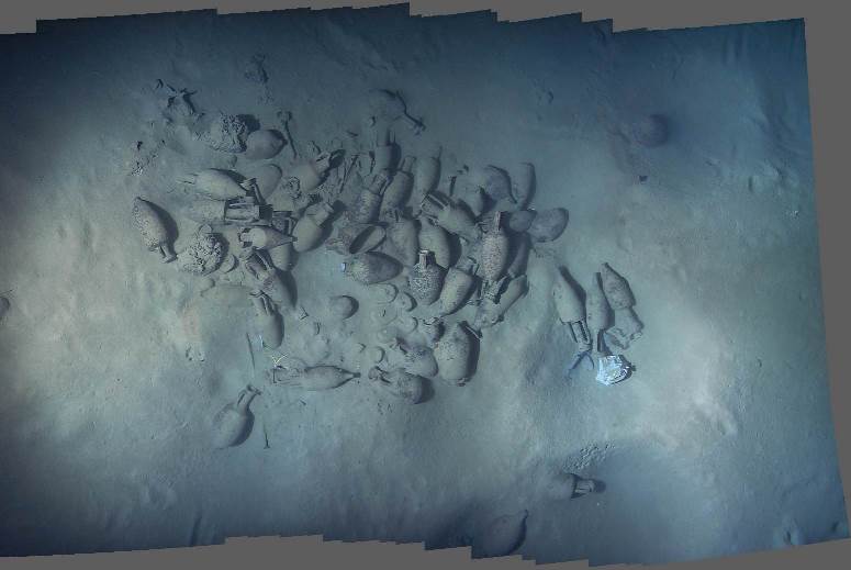
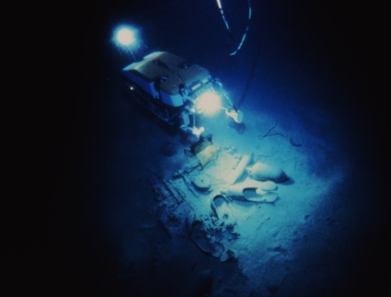
..aquí te encontré una imagen del famoso bajo..  IL Keith, 30 centimetri dalla superficie, 60 miglia dalla costa.. Nel Mediterraneo si tocca a 60 miglia dalla costa più vicina... Il Keith, il "punto zero" del banco Skerki, nel canale di Sicilia grosso modo equidistante tra Tunisia, Sardegna e Sicilia http://www.flickr.com/photos/puntasolchiaro/346821650/
__________________
Un Saludo, Alberto Cabrera. La Mar Brama en Rebeldía... Gotas de agua salada recorren mis labios Y por mis venas.., también gotas de agua salada...
|
|
#9
05-07-2009, 18:50
|
||||
|
||||
|
Ese tío de las gafas y los patos es un...
Que ganas pol dió. Como mola. No tiene que haber peces ni ná. 
|
|
#10
05-07-2009, 19:33
|
||||
|
||||
|
..os dejo un par de cartas más por si alguién tuviese un especial interés por la zona..
 
__________________
Un Saludo, Alberto Cabrera. La Mar Brama en Rebeldía... Gotas de agua salada recorren mis labios Y por mis venas.., también gotas de agua salada...
|
|
Ver todos los foros en uno |
|
|


 Modo lineal

